Clicking moves left
Approach to Lukla airport
1/50
Clicking moves right
Clicking moves left
Arrival at Lukla airport
2/50
Clicking moves right
Clicking moves left
Lukla (2840 m)
3/50
Clicking moves right
Clicking moves left
Lukla (2840 m). Mules and yaks are the only means of transport used on the paths of the Himalayan valleys
4/50
Clicking moves right
Clicking moves left
Lukla (2840 m). Mules and yaks are the only means of transport used on the paths of the Himalayan valleys
5/50
Clicking moves right
Clicking moves left
Fields in the village of Chaurikharka seen from the village of Thalsharoa (2678 m)
6/50
Clicking moves right
Clicking moves left
Fields in the village of Chaurikharka seen from the village of Thalsharoa (2678 m)
7/50
Clicking moves right
Clicking moves left
Woods after the village of Thado Koshigaon (2580 m) on the path towards the village of Chheplung (2660 m)
8/50
Clicking moves right
Clicking moves left
Zdopke, cross between yak and cow. On the horizon, Mount Kongde in Chauri Kharka Valley
9/50
Clicking moves right
Clicking moves left
Leaving Lukla, you pass the village of Chheplung with the big Mani (prayer cylinder)
10/50
Clicking moves right
Clicking moves left
Chheplung (2660 m). In prayer in front of the stone prayers
11/50
Clicking moves right
Clicking moves left
A bearer is preparing to load on his shoulders the load of goods for sale at the village of Namche Bazar (3440 m)
12/50
Clicking moves right
Clicking moves left
Chheplung (2660 m) suspension bridge over the river Thade Koshi Khola
13/50
Clicking moves right
Clicking moves left
Village of Thado Koshigaon (2580 m) with a small Buddhist monastery
14/50
Clicking moves right
Clicking moves left
Zdopke column, a cross between yak and cow, to the village of Thado Koshigaon (2580 m)
15/50
Clicking moves right
Clicking moves left
A small restaurant in the village of Thado Koshigaon (2580 m)
16/50
Clicking moves right
Clicking moves left
Village of Thado Koshigaon (2580 m). View of Mount Kusum Khangkaru (6370 m)
17/50
Clicking moves right
Clicking moves left
Mount Kusum Khangkaru (6370 m)
18/50
Clicking moves right
Clicking moves left
Slopes of Mount Kusum Khangkaru (6370 m)
19/50
Clicking moves right
Clicking moves left
Village of Ghat-Nurning (2592 m) before Phakding. In the background, Mount Kongde (4250 m)
20/50
Clicking moves right
Clicking moves left
Village of Ghat-Nurning (2592 m)
21/50
Clicking moves right
Clicking moves left
Village of Ghat-Nurning (2592 m). Stones and cylinder prayer before a Stupa (sacred monument)
22/50
Clicking moves right
Clicking moves left
Nurning Village (2592 m). Shop of grocery, water and soft drinks
23/50
Clicking moves right
Clicking moves left
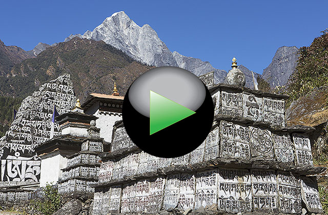
Nurning (2592 m). Prayer stones (Mani)
24/50
Clicking moves right
Clicking moves left
Nurning (2592 m). Prayer stones (Mani)
25/50
Clicking moves right
Clicking moves left
Nurning village (2592 m)
26/50
Clicking moves right
Clicking moves left
Phakding village (2610 m)
27/50
Clicking moves right
Clicking moves left
Phakding village (2610 m). Suspension Bridge before arriving at the village
28/50
Clicking moves right
Clicking moves left
Phakding village (2610 m). Barber
29/50
Clicking moves right
Clicking moves left
Bengkar village (2630 m)
30/50
Clicking moves right
Clicking moves left
Bengkar village (2630 m)
31/50
Clicking moves right
Clicking moves left
Bengkar village (2630 m). Kitchen of restaurant
32/50
Clicking moves right
Clicking moves left
The sacred mountain of Khumbi La. For the Nepalese law, can not be climbed
33/50
Clicking moves right
Clicking moves left
Path after Benkar (2630 m) with on the horizon Mount Thamserku (6618 m)
34/50
Clicking moves right
Clicking moves left
Village of Monjo (2835 m)
35/50
Clicking moves right
Clicking moves left
Village of Monjo (2835 m). Stone prayers
36/50
Clicking moves right
Clicking moves left
Police place to Monjo for permission to enter in the Sagarmatha (Everest) National Park
37/50
Clicking moves right
Clicking moves left
Police place to Monjo for permission to enter in the Sagarmatha (Everest) National Park
38/50
Clicking moves right
Clicking moves left
Entrance to the Sagarmatha (Everest) National Park
39/50
Clicking moves right
Clicking moves left
Roadhouse in Jorsalle Village
40/50
Clicking moves right
Clicking moves left
Jorsale (2740 m). Suspension bridge over the Dudh Kosi River
41/50
Clicking moves right
Clicking moves left
Ascent along the Dudh Kosi River to the longest suspension bridges in the path
42/50
Clicking moves right
Clicking moves left
The two suspension bridges to Larja Dobhan at the confluence of the valleys of the rivers Bhote Koshi and Dudh Koshi
43/50
Clicking moves right
Clicking moves left
The two suspension bridges to Larja Dobhan at the confluence of the valleys of the rivers Bhote Koshi and Dudh Koshi
44/50
Clicking moves right
Clicking moves left
The two suspension bridges to Larja Dobhan at the confluence of the valleys of the rivers Bhote Koshi and Dudh Koshi
45/50
Clicking moves right
Clicking moves left
On the path after Jorsale (2740 m) to Namche Bazaar (3440 m)
46/50
Clicking moves right
Clicking moves left
Viewpoint on the firsts 8000 m before arriving at Namche Bazaar. Everest 8848 m (left) and Lhotse 8516 (right)
47/50
Clicking moves right
Clicking moves left
Viewpoint on the Everest (8848 m) before arriving at Namche Bazaar
48/50
Clicking moves right
Clicking moves left
Arrival in Namche Bazaar (3440 m)
49/50
Clicking moves right
Clicking moves left
The journey from Lukla to Namche Bazaar
50/50
Clicking moves right