World  Travel  Reportage 

Photos and videos of travel, culture, nature, sports by professional reporters

facebook logo
World  Travel  Reportage 
Photos and videos of travel, culture, nature, sports by professional reporters
SEARCH

Grande Terre (New Caledonia)

Clicking moves left

In flight over Nouméa, the capital of New Caledonia

1/50
Clicking moves right

In flight over Nouméa, the capital of New Caledonia

Clicking moves left

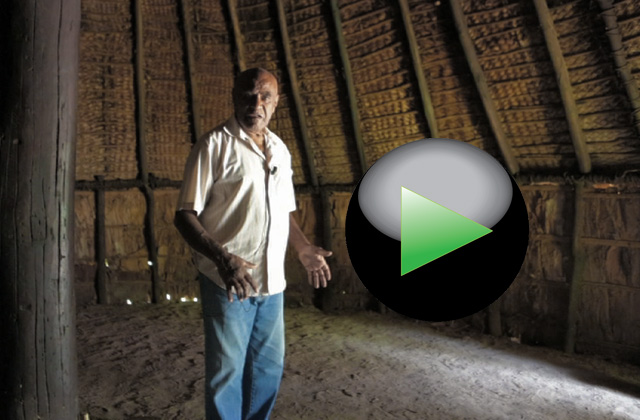
South west coast. The great home of the Petit Couli tribe

2/50
Clicking moves right

South west coast. The great home of the Petit Couli tribe

Clicking moves left

South west coast. The entrance of the common home of the Petit Couli tribe

3/50
Clicking moves right

South west coast. The entrance of the common home of the Petit Couli tribe

Clicking moves left

The roof of a house common of Kanak

4/50
Clicking moves right

The roof of a house common of Kanak

Clicking moves left

Totem entrance of the Kanak tribe villages that living on the island

5/50
Clicking moves right

Totem entrance of the Kanak tribe villages that living on the island

Clicking moves left

Totem entrance of the Kanak tribe villages that living on the island

6/50
Clicking moves right

Totem entrance of the Kanak tribe villages that living on the island

Clicking moves left

West Coast. The forest of Les Grandes Fougères National Park near the village of Farino

7/50
Clicking moves right

West Coast. The forest of Les Grandes Fougères National Park near the village of Farino

Clicking moves left

West Coast. The forest of Les Grandes Fougères National Park near the village of Farino

8/50
Clicking moves right

West Coast. The forest of Les Grandes Fougères National Park near the village of Farino

Clicking moves left

West Coast. The forest of Les Grandes Fougères National Park near the village of Farino

9/50
Clicking moves right

West Coast. The forest of Les Grandes Fougères National Park near the village of Farino

Clicking moves left

This bird called Cagou, it is also the symbol of New Caledonia. Having no predators, the Cagou has forgotten how to fly

10/50
Clicking moves right

This bird called Cagou, it is also the symbol of New Caledonia. Having no predators, the Cagou has forgotten how to fly

Clicking moves left

This bird called Cagou, it is also the symbol of New Caledonia. Having no predators, the Cagou has forgotten how to fly

11/50
Clicking moves right

This bird called Cagou, it is also the symbol of New Caledonia. Having no predators, the Cagou has forgotten how to fly

Clicking moves left

West coast. The Gouaro Bay.

12/50
Clicking moves right

West coast. The Gouaro Bay.

Clicking moves left

West coast. Turtle Bay in the Gouaro Bay.

13/50
Clicking moves right

West coast. Turtle Bay in the Gouaro Bay.

Clicking moves left

West Coast. Roche Percée, the strange rock that also gives its name to the village in the Gouaro Bay

14/50
Clicking moves right

West Coast. Roche Percée, the strange rock that also gives its name to the village in the Gouaro Bay

Clicking moves left

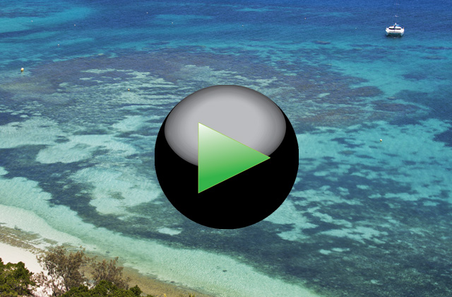
West Coast. The lagoon near the village of Poé defined by UNESCO, World Heritage Site

15/50
Clicking moves right

West Coast. The lagoon near the village of Poé defined by UNESCO, World Heritage Site

Clicking moves left

West Coast. One of the few access pass to the coast in front of the Nature Reserve Domain de Deva

16/50
Clicking moves right

West Coast. One of the few access pass to the coast in front of the Nature Reserve Domain de Deva

Clicking moves left

West Coast. A herd of deer in the Domain de Deva Nature Reserve

17/50
Clicking moves right

West Coast. A herd of deer in the Domain de Deva Nature Reserve

Clicking moves left

North-west coast. The caves of Koumac

18/50
Clicking moves right

North-west coast. The caves of Koumac

Clicking moves left

The red mountains that characterize the landscape in the northern territories

19/50
Clicking moves right

The red mountains that characterize the landscape in the northern territories

Clicking moves left

The northern tip of Grande Terre and, on the horizon, the island of Baaba

20/50
Clicking moves right

The northern tip of Grande Terre and, on the horizon, the island of Baaba

Clicking moves left

The mangrove swamps that characterize the north coast

21/50
Clicking moves right

The mangrove swamps that characterize the north coast

Clicking moves left

The mangrove swamps that characterize the north coast

22/50
Clicking moves right

The mangrove swamps that characterize the north coast

Clicking moves left

Baaba island a few miles from the northern tip of Grande Terre

23/50
Clicking moves right

Baaba island a few miles from the northern tip of Grande Terre

Clicking moves left

East Coast. The ferry on the Oualième river

24/50
Clicking moves right

East Coast. The ferry on the Oualième river

Clicking moves left

East Coast. The estuary of the Oualième river

25/50
Clicking moves right

East Coast. The estuary of the Oualième river

Clicking moves left

The coral platforms that protect for long stretches the east coast.

26/50
Clicking moves right

The coral platforms that protect for long stretches the east coast.

Clicking moves left

East Coast. Village of Hienghène. The cliffs and the lagoon of Lindéralique

27/50
Clicking moves right

East Coast. Village of Hienghène. The cliffs and the lagoon of Lindéralique

Clicking moves left

East Coast. Village of Hienghène. The cliffs of Lindéralique

28/50
Clicking moves right

East Coast. Village of Hienghène. The cliffs of Lindéralique

Clicking moves left

East Coast. The Hienghène Bay. The tropical forest around the bay.

29/50
Clicking moves right

East Coast. The Hienghène Bay. The tropical forest around the bay.

Clicking moves left

Rest area to admire the view of the bay of Hienghène

30/50
Clicking moves right

Rest area to admire the view of the bay of Hienghène

Clicking moves left

The mountains that rise along the east coast of the island near the town of Hienghène

31/50
Clicking moves right

The mountains that rise along the east coast of the island near the town of Hienghène

Clicking moves left

The Hienghène Bay with the island of La Poule (The Hen), so named for of its characteristic shape

32/50
Clicking moves right

The Hienghène Bay with the island of La Poule (The Hen), so named for of its characteristic shape

Clicking moves left

The north side of Hienghène Bay

33/50
Clicking moves right

The north side of Hienghène Bay

Clicking moves left

East coast. The beaches near Poindimié town

34/50
Clicking moves right

East coast. The beaches near Poindimié town

Clicking moves left

River on the east coast

35/50
Clicking moves right

River on the east coast

Clicking moves left

The village of the Bas Coulnà tribe located on the mountains about 30 km from the town of Hienghène

36/50
Clicking moves right

The village of the Bas Coulnà tribe located on the mountains about 30 km from the town of Hienghène

Clicking moves left

The village of the Bas Coulnà tribe hidden among the tropical forest

37/50
Clicking moves right

The village of the Bas Coulnà tribe hidden among the tropical forest

Clicking moves left

The village of the Bas Coulnà tribe

38/50
Clicking moves right

The village of the Bas Coulnà tribe

Clicking moves left

South coast. Prony Bay

39/50
Clicking moves right

South coast. Prony Bay

Clicking moves left

South coast. Prony Bay. The mud carried by rivers crossing the red earths, color the sea water

40/50
Clicking moves right

South coast. Prony Bay. The mud carried by rivers crossing the red earths, color the sea water

Clicking moves left

The red soils that characterize the southern tip of the island

41/50
Clicking moves right

The red soils that characterize the southern tip of the island

Clicking moves left

The red soils that characterize the southern tip of the island

42/50
Clicking moves right

The red soils that characterize the southern tip of the island

Clicking moves left

Southern tip of the island. The artificial lake of Yaté on the Rivière Bleue Park

43/50
Clicking moves right

Southern tip of the island. The artificial lake of Yaté on the Rivière Bleue Park

Clicking moves left

Southern tip of the island. The bridge access to the Rivière Bleue Park

44/50
Clicking moves right

Southern tip of the island. The bridge access to the Rivière Bleue Park

Clicking moves left

Southern tip of the island. The artificial lake of Yatè in the Rivière Bleue Park

45/50
Clicking moves right

Southern tip of the island. The artificial lake of Yatè in the Rivière Bleue Park

Clicking moves left

The artificial lake of Yate in the Rivière Bleue Park. The strongest trees are resistant to water maceration

46/50
Clicking moves right

The artificial lake of Yate in the Rivière Bleue Park. The strongest trees are resistant to water maceration

Clicking moves left

Southern tip of the island. The path into the Rivière Bleue, a large area of land converted in National Park

47/50
Clicking moves right

Southern tip of the island. The path into the Rivière Bleue, a large area of land converted in National Park

Clicking moves left

The ruins at Prony, the first settlement of the settlers came from Europe.

48/50
Clicking moves right

The ruins at Prony, the first settlement of the settlers came from Europe.

Clicking moves left

South Coast. The waterfalls of Madeleine in the botanical garden in the Rivière Bleue National Park.

49/50
Clicking moves right

South Coast. The waterfalls of Madeleine in the botanical garden in the Rivière Bleue National Park.

Clicking moves left

The high mountains of the southern tip of the island in the region of Mont Dore

50/50
Clicking moves right

The high mountains of the southern tip of the island in the region of Mont Dore

In flight over Nouméa, the capital of New Caledonia
South west coast. The great home of the Petit Couli tribe
South west coast. The entrance of the common home of the Petit Couli tribe
The roof of a house common of Kanak
Totem entrance of the Kanak tribe villages that living on the island
West Coast. The forest of Les Grandes Fougères National Park near the village of Farino
This bird called Cagou, it is also the symbol of New Caledonia. Having no predators, the Cagou has forgotten how to fly
West coast. The Gouaro Bay.
West coast. Turtle Bay in the Gouaro Bay.
West Coast. Roche Percée, the strange rock that also gives its name to the village in the Gouaro Bay
West Coast. The lagoon near the village of Poé defined by UNESCO, World Heritage Site
West Coast. One of the few access pass to the coast in front of the Nature Reserve Domain de Deva
West Coast. A herd of deer in the Domain de Deva Nature Reserve
North-west coast. The caves of Koumac
The red mountains that characterize the landscape in the northern territories
The northern tip of Grande Terre and, on the horizon, the island of Baaba
The mangrove swamps that characterize the north coast
Baaba island a few miles from the northern tip of Grande Terre
East Coast. The ferry on the Oualième river
East Coast. The estuary of the Oualième river
The coral platforms that protect for long stretches the east coast.
East Coast. Village of Hienghène. The cliffs and the lagoon of Lindéralique
East Coast. Village of Hienghène. The cliffs of Lindéralique
East Coast. The Hienghène Bay. The tropical forest around the bay.
Rest area to admire the view of the bay of Hienghène
The mountains that rise along the east coast of the island near the town of Hienghène
The Hienghène Bay with the island of La Poule (The Hen), so named for of its characteristic shape
The north side of Hienghène Bay
East coast. The beaches near Poindimié town
River on the east coast
The village of the Bas Coulnà tribe located on the mountains about 30 km from the town of Hienghène
The village of the Bas Coulnà tribe hidden among the tropical forest
The village of the Bas Coulnà tribe
South coast. Prony Bay
South coast. Prony Bay. The mud carried by rivers crossing the red earths, color the sea water
The red soils that characterize the southern tip of the island
Southern tip of the island. The artificial lake of Yaté on the Rivière Bleue Park
Southern tip of the island. The bridge access to the Rivière Bleue Park
Southern tip of the island. The artificial lake of Yatè in the Rivière Bleue Park
The artificial lake of Yate in the Rivière Bleue Park. The strongest trees are resistant to water maceration
Southern tip of the island. The path into the Rivière Bleue, a large area of land converted in National Park
The ruins at Prony, the first settlement of the settlers came from Europe.
South Coast. The waterfalls of Madeleine in the botanical garden in the Rivière Bleue National Park.
The high mountains of the southern tip of the island in the region of Mont Dore

to download this reportage or

VIDEO LINK

New Caledonia - Travel - Back to index

By: Carlo Piccinelli

ID: 18

Where is the New Caledonia
Article.
The journey to discovery the New Caledonia begins in Nouméa, the capital of the archipelago. Renting a car or a motor home to begin your journey along the west coast to visit the forest park in Farino, the beaches of Gouaro Bay and the nature reserve of the Domain de Deva. Continuing on, you visit the caves of Koumac to reach the extreme and wild north. Going down the east coast, the coast of the tribes Kanak, you will discover the cultures and traditions of the population that lives in the archipelago. The totems, the big tribal houses, the mountain villages such as Bas Coulna or coastal ones as Hienghène or Poindimié until you reach the red earths of the south to visit the Nature Reserve Rivière Bleue and the first colonial settlements in Prony. Approximately 1500 km of nature, culture and fun.
More informations:
To reach New Caledonia, departures from major airports in the world with Aircalin (Air Calédonie International) www.aircalin.com
Rivière Bleue, www.destinationgrandsud.nc
Park Des Grandes Fougères, www.lafoatourisme.nc
Rent a motor home, www.campingcar.nc
Tourism Office Noumea, www.office-tourisme.nc
www.visitenouvellecaledonie.com