Clicking moves left
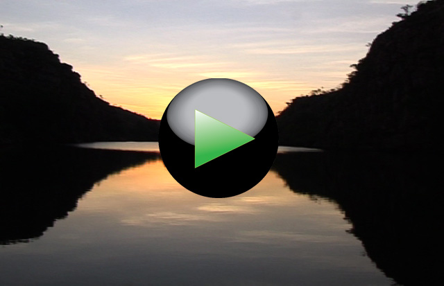
Tourist boat to visit the marshes generated by the Yellow River near the town of Cooinda
1/49
Clicking moves right
Clicking moves left
The marshes (Billabong) generated by the Yellow River near Cooinda
2/49
Clicking moves right
Clicking moves left
The marshes (Billabong) generated by the Yellow River near Cooinda
3/49
Clicking moves right
Clicking moves left
Along the banks of the Yellow Rivers, grow thousands of water lilies
4/49
Clicking moves right
Clicking moves left
Kangaroos along the Yellow River near Cooinda
5/49
Clicking moves right
Clicking moves left
Yellow River is known for the hundreds of crocodiles that inhabit its banks and its waters
6/49
Clicking moves right
Clicking moves left
Yellow River is known for the hundreds of crocodiles that inhabit its banks and its waters
7/49
Clicking moves right
Clicking moves left
Yellow River is known for the hundreds of crocodiles that inhabit its banks and its waters
8/49
Clicking moves right
Clicking moves left
Yellow River is known for the hundreds of crocodiles that inhabit its banks and its waters
9/49
Clicking moves right
Clicking moves left
Gunlom Falls. Area of waterfalls and pools where you can swim without the danger of crocodiles
10/49
Clicking moves right
Clicking moves left
Gunlom Falls in the south west area of Kakadu National Park
11/49
Clicking moves right
Clicking moves left
Gunlom Falls. Natural pools where is possible to swim
12/49
Clicking moves right
Clicking moves left
Gunlom Falls. Natural pools where is possible to swim without the danger of crocodiles
13/49
Clicking moves right
Clicking moves left
Katherine Gorge (Nitmiluk National Park). Rocky canyon with river cruises
14/49
Clicking moves right
Clicking moves left
Katherine Gorge (Nitmiluk National Park). The rocky cliff of the canyon
15/49
Clicking moves right
Clicking moves left
Katherine Gorge (Nitmiluk N.P.). The park guide during the river cruise
16/49
Clicking moves right
Clicking moves left
Katherine Gorge (Nitmiluk National Park). The rocky cliff of the canyon
17/49
Clicking moves right
Clicking moves left
Katherine Gorge (Nitmiluk National Park). On board during the river cruise
18/49
Clicking moves right
Clicking moves left
Katherine Gorge (Nitmiluk National Park). The rocky cliff along the river
19/49
Clicking moves right
Clicking moves left
Katherine Gorge (Nitmiluk N. P.). A ranger wait the boat with the tourist
20/49
Clicking moves right
Clicking moves left
Katherine Gorge in Nitmiluk National Park. The rocky cliff along the river
21/49
Clicking moves right
Clicking moves left
Katherine Gorge in Nitmiluk National Park. In kayak on the river
22/49
Clicking moves right
Clicking moves left
Katherine Gorge in Nitmiluk National Park. In kayak on the river
23/49
Clicking moves right
Clicking moves left
Katherine Gorge. In kayak along the river near the beach where the crocodiles deposit their eggs
24/49
Clicking moves right
Clicking moves left
Katherine Gorge in Nitmiluk National Park
25/49
Clicking moves right
Clicking moves left
Buchanan Hightway. On the dirt road to Top Spring
26/49
Clicking moves right
Clicking moves left
Gregory NP. Baobab along the dirt road to Bullita (old village of farmers)
27/49
Clicking moves right
Clicking moves left
Gregory NP. Baobab along the dirt road to Bullita (old village of farmers)
28/49
Clicking moves right
Clicking moves left
Gregory National Park, abandoned village of Bullita
29/49
Clicking moves right
Clicking moves left
Gregory National Park. Kakatoa parrots
30/49
Clicking moves right
Clicking moves left
Dinghi along the road
31/49
Clicking moves right
Clicking moves left
There are many wild horses that you can see along the road
32/49
Clicking moves right
Clicking moves left
There are many wild horses that you can see along the road
33/49
Clicking moves right
Clicking moves left
Daly Waters Pub, meeting point of the aviators during World War II stopped here to refuel during transfers from coast to coast
34/49
Clicking moves right
Clicking moves left
Daly Waters Pub, meeting point of the aviators during World War II stopped here to refuel during transfers from coast to coast
35/49
Clicking moves right
Clicking moves left
The “road train” along the Stuart Highway
36/49
Clicking moves right
Clicking moves left
Devil Marbles Conservation Reserve near the Stuart Highway not far from Alice Spring
37/49
Clicking moves right
Clicking moves left
Devil Marbles Conservation Reserve near the Stuart Highway
38/49
Clicking moves right
Clicking moves left
Devil Marbles Conservation Reserve. A large area characterized by particular formations of spherical rocks
39/49
Clicking moves right
Clicking moves left
Devil Marbles Conservation Reserve. A large area characterized by particular formations of spherical rocks
40/49
Clicking moves right
Clicking moves left
Devil Marbles Conservation Reserve
41/49
Clicking moves right
Clicking moves left
Devil Marbles Conservation Reserve
42/49
Clicking moves right
Clicking moves left
Devil Marbles Conservation Reserve. A rock split from the hot/cold that characterizes this area
43/49
Clicking moves right
Clicking moves left
Devil Marbles Conservation Reserve
44/49
Clicking moves right
Clicking moves left
Devil Marbles Conservation Reserve
45/49
Clicking moves right
Clicking moves left
Devil Marbles Conservation Reserve
46/49
Clicking moves right
Clicking moves left
Devil Marbles Conservation Reserve near the Stuart Highway not far from Alice Spring
47/49
Clicking moves right
Clicking moves left
In the desert, there is no light pollution and in the night, the sky appears in all his splendor
48/49
Clicking moves right
Clicking moves left
The road from Darwin to Alice Spring
49/49
Clicking moves right